




Ask anyone who runs a warehouse where the unplanned hours go, and the answer is rarely picking or packing. It is looking for things. A pallet moved during a busy shift. A return that never went back to its slot. A batch someone put in the overflow aisle "just for today" three weeks ago.
Most companies already own software that should answer this. An ERP knows how many units exist. A spreadsheet knows what was received. Neither reliably knows where a specific item is standing right now, because location is the one field nobody updates when the floor gets busy.
Quantity and location are different problems
Inventory systems are built around quantity, value and movement between accounts. They model the warehouse as a list. But a warehouse is a physical space, and the question staff actually ask is spatial: which zone, which rack, which level, which slot. A list cannot answer that question, so people answer it from memory instead, and memory does not survive shift changes, holidays or staff turnover.
The cost is easy to underestimate because it never appears as a line item. It shows up as delayed dispatches, duplicate purchases of stock that was already on site, stock counted twice, and experienced staff being interrupted because only they know where things live.
What a spatial layer actually is
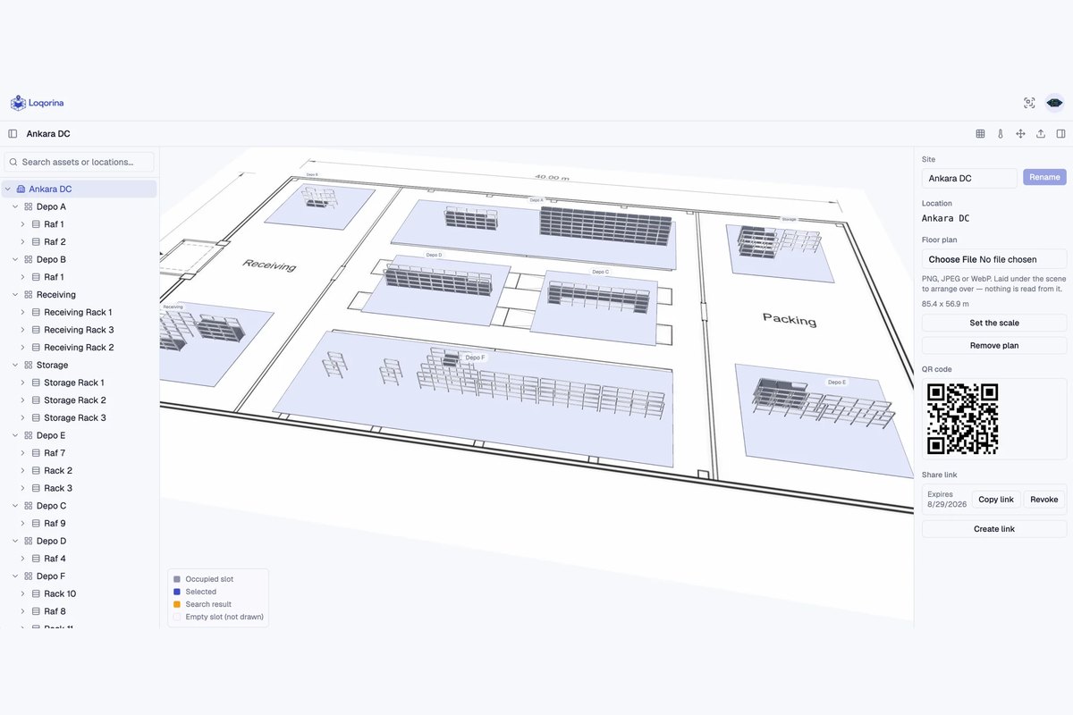
A spatial layer is a 3D model of the site covering zones, racks, levels and slots, with your existing asset data attached to it. Instead of reading a location code and translating it in your head, you see the building. Searching for an asset moves the camera to the slot it is standing in.
This is not a visualisation gimmick. Once locations are modelled as real positions rather than text strings, the system can answer questions a list cannot: what is near the dispatch door, which aisle is congested, which zone has not been verified in a month.
QR codes turn movement into data
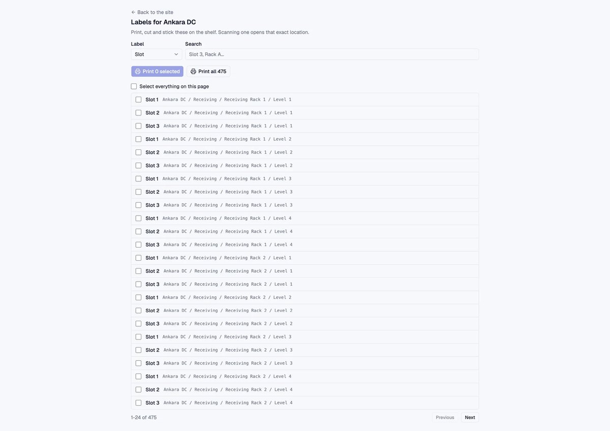
The hard part of any location system is capture: keeping the data current without adding work. The practical answer is a printable QR label on every location. No handheld scanners and no new hardware are needed; a phone camera is enough.
Scanning a location and an asset records the placement in seconds. Because warehouse wifi is rarely reliable in every corner, scans queue offline and sync when the connection returns. The capture step has to survive real conditions or the data goes stale within a fortnight.
What changes day to day
- Search that answers "where": enter an asset or location and the view flies to it.
- Freshness: see which zones have not been scanned recently, so you know where the data is drifting.
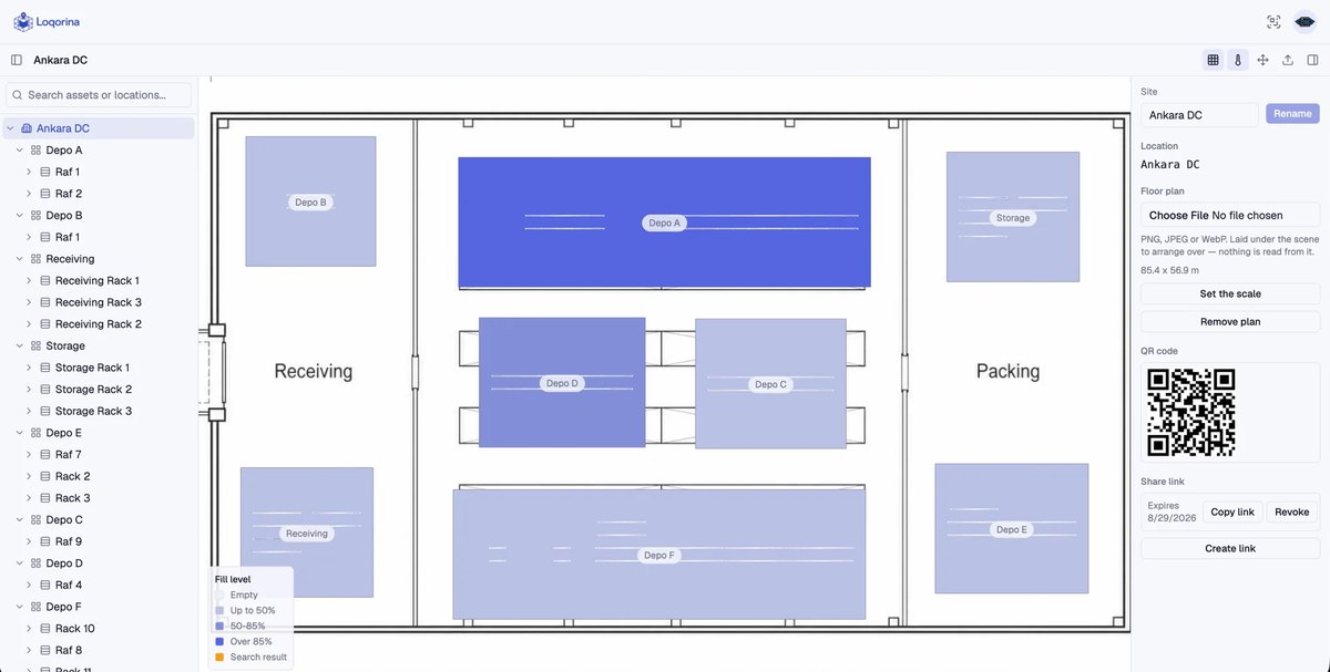
- Occupancy heatmaps: see fill levels across zones before deciding where to put an incoming load.
- Movement history: every location change is recorded, so "who moved it" stops being guesswork.
Deliberately not another system of record
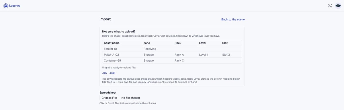
The most common objection is reasonable: nobody wants to replace a working ERP or WMS. A spatial layer should not ask you to. It reads the asset data you already maintain, where a CSV or Excel export is enough to start, and adds the dimension your current system does not model.
That distinction matters commercially. Replacing a system of record is a multi-year programme with migration risk. Adding a spatial layer on top is a contained project that can be piloted in one zone and abandoned cheaply if it does not earn its place.
How to start
- Model one site, not the whole network. A single building proves or disproves the value.
- Label the locations. Print QR codes for zones, racks and slots.
- Import what you already have. Map an existing asset export onto the model.
- Scan for two weeks. Let normal operations populate the twin.
- Measure one number. Time spent locating items before and after.
If that number does not move, the project should stop there. That is exactly why the pilot is worth running before committing to a rollout.
FKT Software builds Loqorina, an interactive 3D spatial layer for warehouses, alongside custom operational software for European SMEs. See our custom software services and selected work.